Daniel’s Levada Directory
2 July 2016 Paul da Serra
Also known as Tour 2016-07-02 Paul da Serra
Archival documentation — not a current hiking recommendation. Source file on danishome.ch last modified: 12 June 2020
Course
The plan had actually been a walk to the Madre of the Levada do Norte, on to the Seixal, the Hortela waterfall and an ascent via the Relvinha. But as so often it is a lottery with the 'cloud'; at the planned start we were met by rain and cloud. Since we were already on the Paul, we improvised a little: a visit to the caves at Loiral near Cristo Rei, and afterwards a wellness tour through the gorse.
The start was at the track to the large wind turbines, just before Cristo Rei on the Paul. We almost failed to find the caves in the overgrown ground. After that, on the plateau, first following the Levadinha da Serra and then along a geocacher highway through the gorse, which is otherwise hard to get through, to Nossa Senhora da Serra and to the dam on the Ribeira do Bezerro. Back along the road, and along the dam walls and outflow channels of the winter reservoir, along the road back to the start.
Distance: 10.5 km, 130 m of ascent, 130 m of descent
Start: 10.50 Paul da Serra
End
15.30 Paul da Serra
Condition
Pathless to the caves, always going by feel through the undergrowth
The gorse is harmless from a distance; close up, without the cacher highway, it is only hard work to get through. Even so, the flora is beautiful!
Notes
Surprising experiences and discoveries in the thicket; on the way back we spotted a group of storks
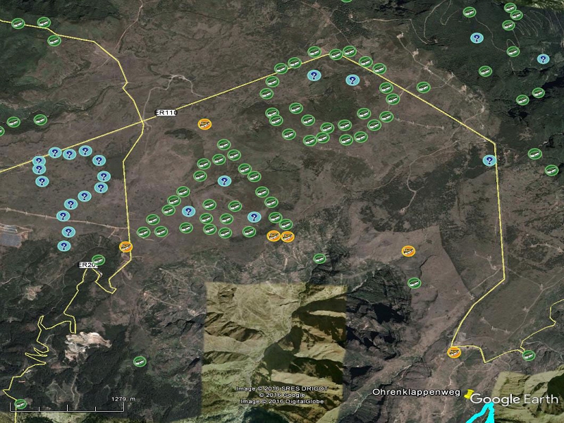
If the route looks odd, take a look at where the geocaches sit on the Paul da Serra: