
Daniel’s Levada Directory
Levada do Castelejo
Also known as Levada Novo da Porto da Cruz
Archival documentation — not a current hiking recommendation. Source file on danishome.ch last modified: 2 April 2022
Area
Sao Roque do Faial/Northeast
Length
11,8 Km
Madrei
Ribeira Sao Roque N 32°44.700 W 16°51.700 ca. 340 m a.s.l.
Course
The Levada do Castelejo can be divided into 2 sections:
Section 1: From the Madre it soon becomes somewhat exposed, but is normally well protected, with views of Sao Roque de Faial; at a bend in the levada there are interesting chances for a striking little souvenir picture; the Levada do Castelejo sup. branches off (see below); an acute bend with a fine view of the Penha de Aguia; a possible descent on a narrow path to Cancela (circular walk Lombo Grande, see below); it passes a reservoir fed by the side branch; a chlorination station for the drinking water; crossing with the Caminho da Terra Baptista
Section 2: From the crossing, through fields below the side levada; crossing with the Caminho do Moinho. Here the Levada da Penha de Aguia branches off; to the south the Vereda da Terra Batista leads to the Pico do Suna, with the option of turning off onto the Levada do Furado (circular walk via the Portela pass, see below).
The levada meets the Caminho da Rochina and continues across the fields towards Tem-Te-Nao-Caias. From here it runs more or less along the Caminho Tem-Te-Nao-Caias, which branches off the ER-108 (caution: cul-de-sac!).
On a stretch below the ER-108, a tunnel under the Caminho do Moleiro or Caminho da Referta, which also branches off the ER-108 in Referta. Another stretch below the ER-108, then the crossing with the ER-108; on the other side of the road it continues, and here a regional road also branches off and continues alongside the levada. Always below the regional road as far as the crossing with the Caminho do Larano, which branches off the regional road.
Another 300 metres from here, then the levada ends.
In section 1 the Levada do Castelejo sup. branches off. It runs a few metres above the main levada, feeds a reservoir, and then continues inside the cultivated fields.
End
Cruz da Guarda ca. 290 m a.s.l.
Function and use
Irrigation of the area around Cruz, Achada and Gambao
Access
Section 1:
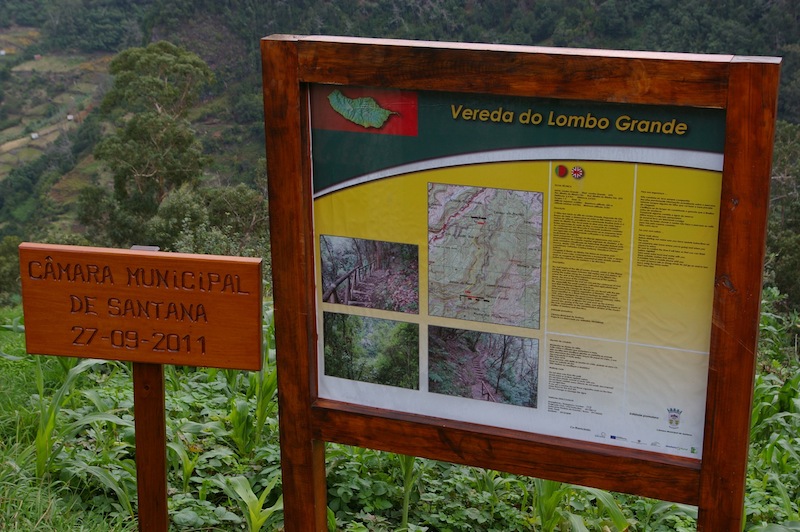
- Path from Lombo Grande to the Madre; after Lombo Grande you turn off the ER-103 here and take the first turning on the right. The path begins at this board:
-
Ascent from Cancela
-
Entry point at the Caminho da Terra Batista; it can also be reached via the Caminho do Lameiro from the ER-108.
Section 2:
-
Caminho do Moinho from the ER-108 to the crossing with the levada; here also the Vereda da Terra Batista from the Pico do Suna
-
You can shorten the way from Referta to Machapez on a regional road; in Macapez it begins here, in Referta here (do not miss the turning before Achada, or you end up in Porto da Cruz). From this road you can reach the levada via the Caminho da Rochina
-
Crossing with the Caminho Tem-Te-Nao-Caias (see above)
-
Crossing with the Caminho do Moleiro or Caminho da Referta
-
Crossing with the ER-108
-
Various accesses from the regional road
-
Crossing with the Caminho do Larano; nearby the Caminho Municipal Portela-Cruz Da Agra comes down from the Portela pass
-
Later you join the regional road from the end of the Levada da Portela
-
A little further north-east the descent path from the Estrada Florestal da Serra Das Funduras meets this road
-
Right here you can turn off towards Larano, to the coastal path to the Boca do Risco, or climb to the Estrada Florestal da Serra Das Funduras
Condition
Easy to moderate (around the Madre, and a little further on, you need to take some care, depending on the landslide situation)
Remarks
In its original form the Levada do Castelejo supplied the areas around Terra Baptista and fed the two levadas around the Penha de Aguia (Levada da Penha de Aguia). Only with an enlargement in the 1950s and 60s, under the plan of the Comissão Administrativa dos Aproveitamentos Hidráulicos da Madeira, could the volume of water also be increased, and the levada was extended to its present end.
The stretch from Cruz to Gambao is therefore also known as