
Daniel’s Levada Directory
Levada do Pico das Eiroses
Also known as Levada da Gaula, Levada do Pico das Iroses
Archival documentation — not a current hiking recommendation. Source file on danishome.ch last modified: 24 August 2021
Area
Aguas Mansas, Gaula/East
Length
8 km
Madrei
Ribeira da Boaventura N 32°42.40 W 16°51.550 ca. 950 m a.s.l.
Course
The levada can be divided into 4 sections:
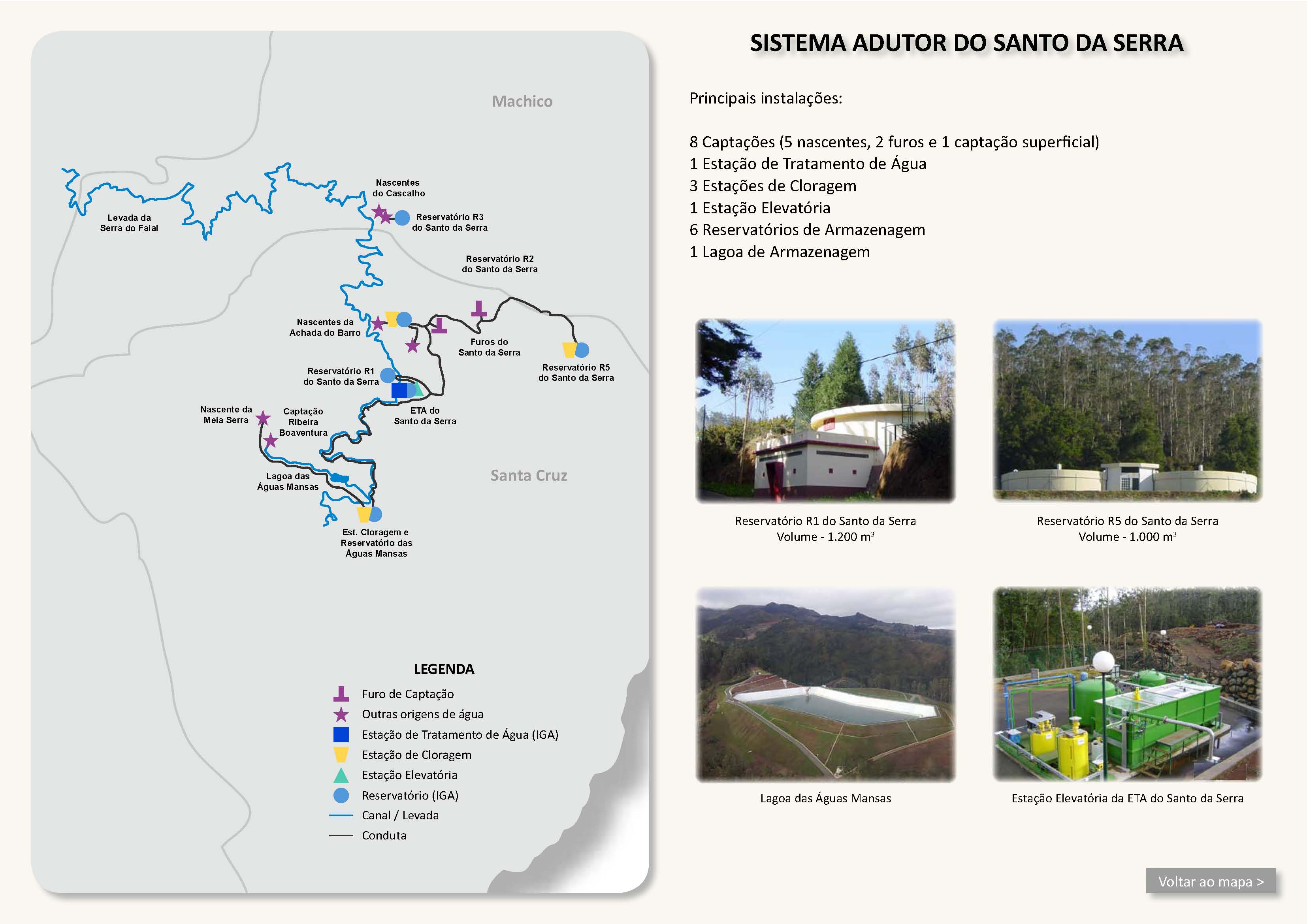
Section 1: Madre to the Lagoa das Aguas Mansas. A stream that flows into the source stream after the Madre is led into the Madre by a small levada.
Section 2: Lagoa das Aguas Mansas to Aguas Mansas
Section 3: Aguas Mansas to the Levada dos Tornos, west of the Pico das Eiroses
Section 4: Levada dos Tornos via Gaula to the end in Lajes, at first more or less along the ER-206 until the road turns away to the east, then vertically across Levadas and Fazenda. On the lower course one meets the restored Moinho do Frigideira
End
Lajes/Porto Novo (ca. 130 m a.s.l.)
Function and use
Part of the Santo da Serra water-supply system, together with the Levada da Serra do Faial; later an optional feeder to the Levada dos Tornos and, further down, irrigation along the ER-206 to the coast
Access
Section 1:
-
Via the Levada da Serra do Faial
-
From Aguas Mansas via the gravel track to the Lagoa das Aguas Mansas
Section 2:
-
Aguas Mansas on the ER-102,
-
Direct access from the ER-102 is likely to be a bit tight...
Section 3:
-
From the ER-206 to the crossing with the Levada dos Tornos
Section 4:
-
Road from the ER-206 to Pico de Gaula
-
Gaula
-
Regional road in Levadas
-
Fazenda
-
Lajes
Condition
Section 1: no problem, largely a track beside the levada
Section 2: somewhat overgrown, but no problem
Section 3: somewhat hard to reach around the Pico das Eiroses
Section 4: no problem
Remarks
The Lagoa das Aguas Mansas (completed 2010) (215'000m3) is one of the 5 large reservoirs on Madeira, alongside those at Portela (100'000 m3), Santo Serra (800'000 m3), Ponta Pargo (100'000 m3) and Paul da Serra (500'000 m3).