
Daniel’s Levada Directory
Levada do Rei
Also known as Levada do Asilo (São Jorge), Levada de São Jorge
Archival documentation — not a current hiking recommendation. Source file on danishome.ch last modified: 25 June 2025
Area
Sao Jorge/Northeast
Length
7 km
Madrei
Ribeiro Do Bonito N 32°47.750 W 16°56.250
Course
Along the Ribeiro do Bonito, first on gentle ground, then along a rock face and through under a waterfall (one of the most photographed places on Madeira), on well protected and a little exposed to the point where the poorly visible old access path (once a gravel track) branches off east towards Chao das Faias. On along the rock face, with good protection, to the only tunnel; then the levada turns west around the next lombo.
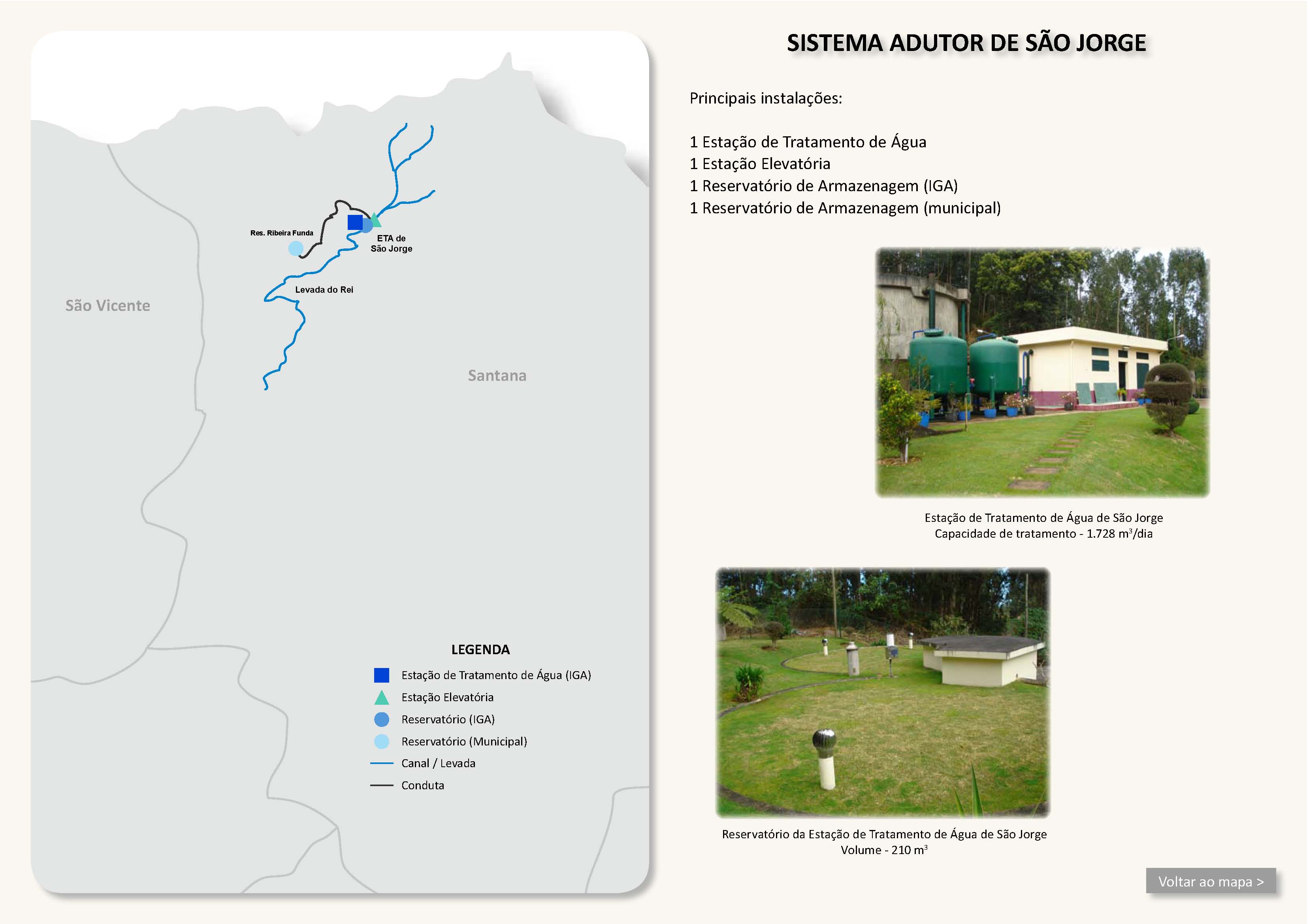
The path now becomes wider. From above, a path comes down to an intake of a feeder levada and of the drinking-water main. The drinking-water main is taken into a rectangular water chamber on the levada and then runs on to Sao Jorge in a pipe buried in the levada path (here better called a levada track). Maintenance is done with vehicles, hence a width a jeep can use. Next comes the crossing of the Ribeira do Sebastian; here a shortcut branches off to the gravel track from the Levada do Rei car park to the Posto Florestal do Cascalho de S. Jorge and on to the Boca das Voltas. The levada continues with, in places, a spectacular view of the lombos and valleys towards Pico Ruivo. The levada leaves the valley and runs in a series of bends to the equally often photographed section, where it flows steeply and noisily down beside a stairway and is led, in an equally photogenic collecting structure, into a large reservoir.
From here the levada flows on to the car park at the classic start of the levada walk. Here it divides into 2 terminal branches. The southern branch feeds the last water mill on Madeira that is still working (Moinho a Agua de Sao Jorge) and ends at Pico; the northern one divides again after 700 metres. The more southerly branch divides once more, and both branches cross the ER-101 here and here and end at Achada Grande. You pass the more northerly branch on the ER-101, shortly before the turn-off from the ER-101 towards Ribeira Funda. The branches end in the area of Tanque and of Eira do Pico.
End
3 terminal branches: Tanque (ca. 330 m a.s.l.), Eira do Pico (ca. 340 m a.s.l.), Pico (ca. 430 m a.s.l.)
Function and use
Water supply around Achada Grande and Sao Jorge; an essential part of the drinking-water supply of Sao Jorge and the surrounding area
Access
-
Path (the old access track) from Chao das Faias
-
Descent from the Boca das Voltas or Chamine to the crossing of the Ribeira do Sebastian
-
To the car park
-
The road from Ilha to Sao Jorge is useful for a (demanding) circular walk
Condition
Straightforward, a few exposed spots, but they are well protected
Year built
ca. 1966. The access path to the tunnels of the Levada dos Tornos at Chao das Faias ran here; the part that is still wide today corresponds to that track. From the turn-off of the track towards Lombo do Meio it becomes narrower.
Remarks
Today's Levada do Rei is the youngest of 3 levadas that rose in the Ribeiro Bonito and ran along the Lombo de Ribeiro Lourenço. The oldest, and the highest, is the Levada (Velha) de Cima de Sao Jorge; the middle one is the Levada do Meio ou Escalferreiro.