
Daniel’s Levada Directory
Levada Nova de Machico
Archival documentation — not a current hiking recommendation. Source file on danishome.ch last modified: 6 January 2024
Area
Marocos, Machico, Queimadas
Length
7 km
Madrei
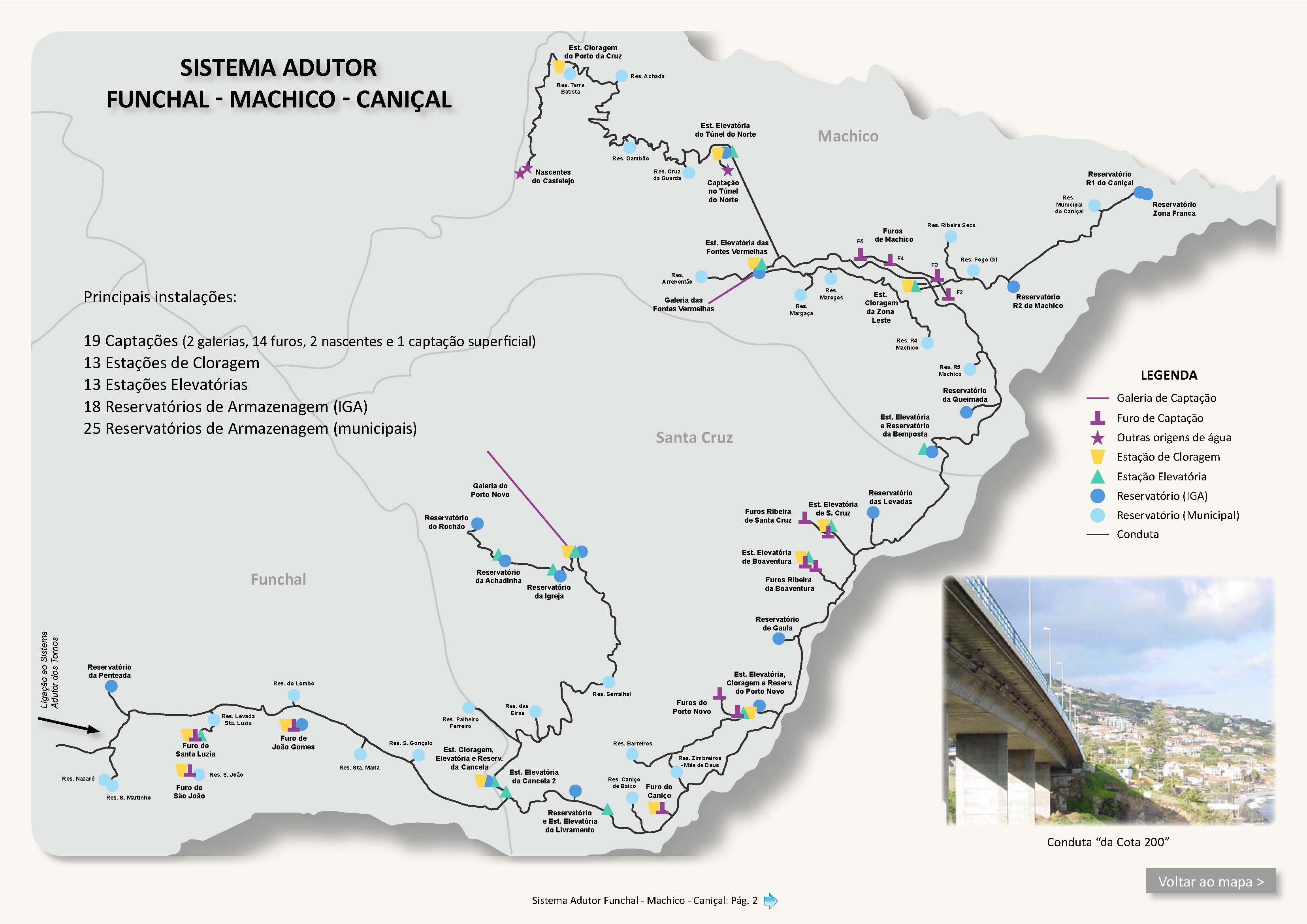
Ribeira de Machico (Marocos) N 32°44.000 W 16°48.800 ca. 336 m a.s.l., currently fed from the Sistema Elevatorio das Fontes Vermelhas
Course
After the old Madre, right in the Ribeira de Machico, comes a basin fed by 3 pipes (not from the river), which forms the Madre of the Levada do Marocos 2; dry under the access road to the intake of the Galeria das Fontes Vermelhas, as far as below the large retaining wall of the intake. Water is led into the levada here. I cannot say whether the old Madre is still in use in times of abundant water; in any case the levada bed is still intact and continuous.
After a few metres a thick drinking-water pipe also comes out of the intake and accompanies the levada for the next 2 kilometres on the mountain side, in places with fine old rusted valves and a completely moss-covered surface! The levada first runs without difficulty above the Ribeira de Machico, then turns west and afterwards lies practically sheer above the expressway in Marocos. Unprotected and narrow for about 400 metres, over occasionally wet spots. At first glance it looks more dramatic than it really is. The levada is piped in this section, so you can also walk in the levada bed, but you are never quite sure whether it will really take your weight.
The levada then leaves the rock face and continues, still somewhat exposed, to a small water house, which is followed by a small levada bridge over the Ribeira da Alfurada. The little house does not seem to be connected to the thick drinking-water pipe, but to other feeder water pipes. On the flaking render you can make out something like Estacao Elevatorio, so according to the map it could be connected with the drinking-water pipes and the Reservatorio Margaca.
On across terraces that are now only partly maintained, to the junction with the ascent path from Marocos to the Caminho da Lombada. Now easy as far as the junction with the Caminho da Lombada, where the drinking-water pipe also disappears under the road.
Past a ruined water mill, across fields to the junction with the ER-108.
The levada now runs above cultivated terraces, past the Caminho do Lombo Martel from the ER-108 and over a stream crossing, where the levada is led separately on a small aqueduct, to an access via the Vereda de Sao Cristovao from the ER-108. Past a large water tank, where the Vereda do Lombo Fazenda also comes up from the ER-108, above terraces, another access via the Vereda do Caramanchao from the ER-108, a stream crossing, then an old reservoir is reached, which can be reached by a road and gravel track from the ER-108. From here the levada runs in a system of channels around a prominent rock. The levada cannot be walked in this section, but it can be followed by a bypass path (see the pictures of the Caminheiros Anónimos da Madeira). After the rock passage there is another chance to descend to the access road from the ER-108.
From here the levada runs about another 100 metres and becomes increasingly overgrown and also exposed; parts have broken away.
Originally it ran about 1.5 Km further through the woodland and on the lombo at Queimadas, by a high-voltage line, to a junction with a regional road. It then split into 3 larger terminal branches, which crossed the ER-239 here, here and here. The terminal branch is ruined and no longer visible.
Below the balconies a side branch comes in. It first runs piped from the reservoir, comes to the surface, and runs first briefly vertical, then more or less horizontal, to the junction with the ascent path to the Miradouro da Queimada. Water does not always run in this section!
On the way a small side levada goes downhill. The main branch crosses the path and then continues at a varying gradient to the fields above the VR1, where it ends in a small reservoir.
From here you can descend to the VR1 and to Machico on a more or less decent trodden path, though at the crossing with the motorway you have to go about it in a somewhat unconventional way!
End
Queimada ca. 190 m a.s.l.
Function and use
Irrigation of the area around Marco, Landeiros, above Marocos and Machico (south side), and formerly Queimada
Access
-
To the Madre from the side road of the Caminho Faja dos Rolos (ER-236) to the Sistema Elevatorio das Fontes Vermelhas,
-
Stepped ascent from Marocos or descent from the Caminho da Lombada
-
Junction with the Caminho da Lombada
-
Descent from the ER-108 via the Vereda da Cova
-
Junction with the ER-108
-
Ascent from the ER-108
-
Ascent via the Caminho do Lombo Martel from the ER-108
-
Access via the Vereda de Sao Cristovao from the ER-108
-
Access via the Vereda do Lombo Fazenda from the ER-108
-
Access via the Vereda do Caramanchao from the ER-108
-
Gravel track to the reservoir and to the Rock from the ER-108
-
Junction with the regional road that branches off the ER-239
-
Junction of terminal branch 1 with the ER-239
-
Junction of terminal branch 2 with the ER-239
-
Junction of terminal branch 3 with the ER-239
Condition
Some places are very exposed; you walk practically sheer above the expressway. The levada path is in good condition, though, and the other places are straightforward to walk
Remarks
Also connected to this system is the terminal branch of the drinking-water pipe that runs parallel to the Levada do Castelejo and is led in the Tunel do Norte to the Fontes Vermelhas. See also Levada do Marocos 2 (more information)
In the area of the rock passage, water comes out of the mountain from a place that cannot be reached and is taken into a small levada.