
Daniel’s Levada Directory
Levada do Marocos 2
Also known as Levada do Maroços 2, Levada das Travessas (Marocos)
Archival documentation — not a current hiking recommendation. Source file on danishome.ch last modified: 17 November 2021
Area
Maroços
Length
2.25 Km
Madrei
Ribeira de Machico N 32°44.000 W 16°48.800 ca. 336 m a.s.l.
Course
From the reservoir at the old Madre of the Levada Nova de Machico, which is fed with water through 3 pipes, over the reservoir outlet into a pipe that at first lies in the bed of the Ribeira de Machico. The pipe is led onto a ledge that, after a few metres, becomes an open levada. After about 100 metres a vertical pipe, which passes under the stream bed from the direction of the Galeria das Fontes Vermelhas, comes up to the levada and disappears into a kind of concrete block on the mountain side. I suspect it is a connecting pipe between the Sistema Elevatoria das Fontes Vermelhas and the drinking-water pipe installed in the expressway tunnel, starting from the pipe in the Levada do Castelejo and the Est. Elevatorio du Tunel do Norte (see drinking-water supply).
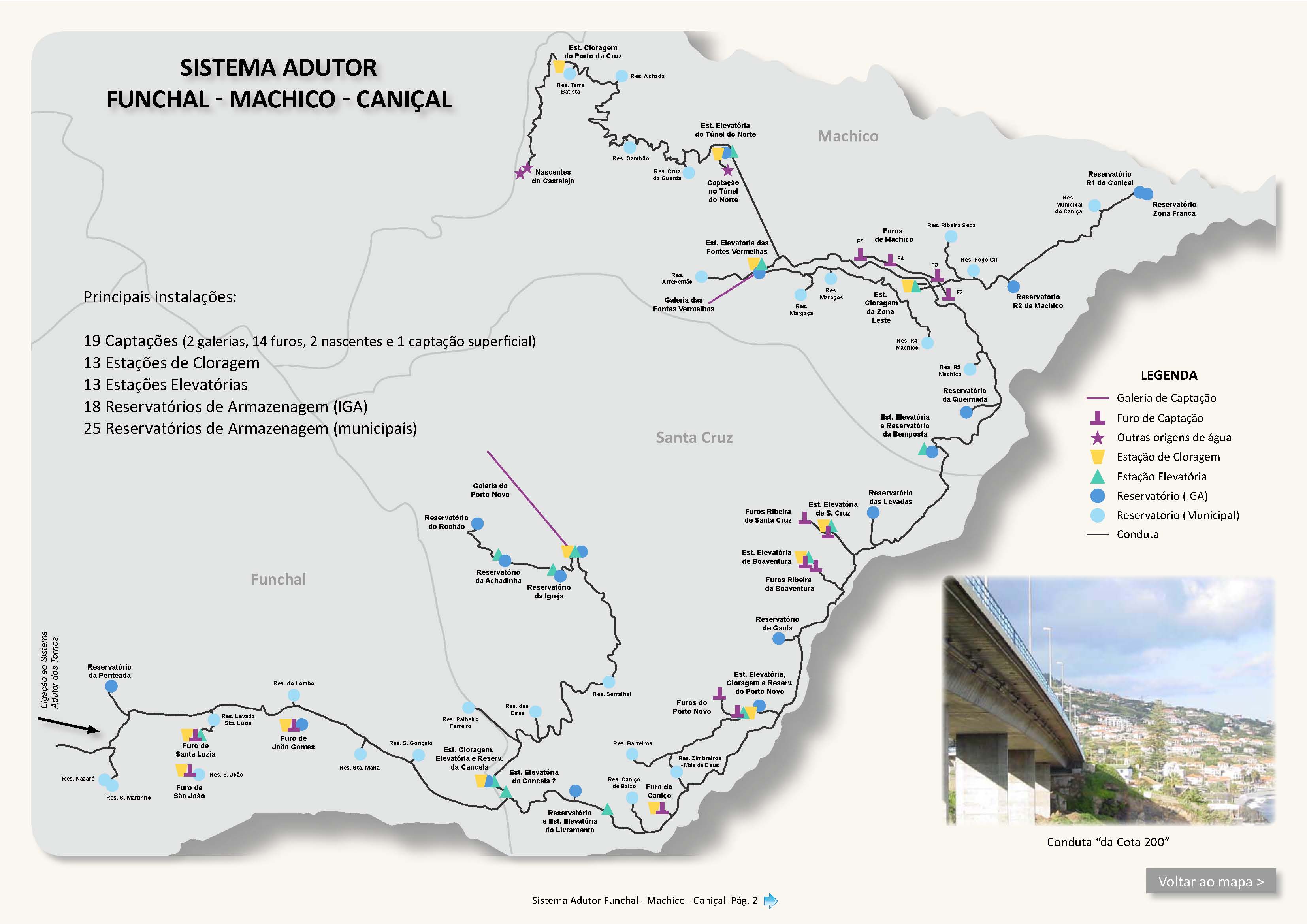
Shortly after that there is a small water house on the valley side of the levada. Then it opens out, you cross the tunnel portal of the expressway, and here 2 thinner pipes stick up out of the levada path again. Soon after comes the crossing with the Caminho Faja dos Rolos (ER-236), which leads up to Ribeira de Machico, to the ER-108 and to the Portela pass (3 approaches to the gravel-track network between the Casa das Funduras and the Portela pass)
Onwards, first in the open, then after a stream crossing the crux: the passage of a fairly high rock slab where the little levada wall is broken and the course is badly exposed. After that, on above terraces until the levada turns north; here it is exposed again for a stretch, then once more high above the terraces of Maroços. A steep path also comes up here from the Levada do Canical. Another deeply cut stream crossing to the end of an access road and a path from Maroços. On over terraces, 2 access paths from the valley, which join higher up into one of the few footpaths to the gravel-track network between the Portela pass and the Casa das Funduras. After a further access path from the Levada do Canical and the Levada do Marocos 3 lying below, the levada no longer seems to be maintained. First quite exposed, then slipped and fallen away; later a green paradise opens up, with countless terraces that are intensively used. Here the levada is clearly visible again as far as the end in the valley of the Ribeira das Cales. An intake from a higher spring also leads to the end.
End
Valley of the Ribeira das Cales ca. 280 m a.s.l.
Function and use
Irrigation of the northern slopes of Marocos and in the valley of the Ribeira das Cales
Access
-
To the Madre from the side road of the Caminho Faja dos Rolos (ER-236) to the Sistema Elevatorio das Fontes Vermelhas,
-
To the Madre via the Levada Nova de Machico
-
Crossing with the Caminho Faja dos Rolos (ER-236)
-
Various paths up from the Levada do Canical
-
From the Estrada dos Marocos over the bridge and along the new road to the crossing with the levada
-
To the end by the path up from the Levada do Canical
-
To the end via the Madre of the Levada do Marocos 4
Condition
The stretch from the road crossing to the Madre is straightforward at the start, but then becomes quite exposed near the stream bed; at the end the path shrinks to a small ledge with the water pipe, still a few metres above the stream bed, quite dangerous!
In the other direction, from the crossing with the ER-236, it is straightforward at first, then comes a very narrow, exposed crux.
Remarks
A relatively dangerous levada to walk; a possible circuit with the other Maroços levadas and the Levada Nova de Machico