Daniel’s Levada Directory
Levada Nova
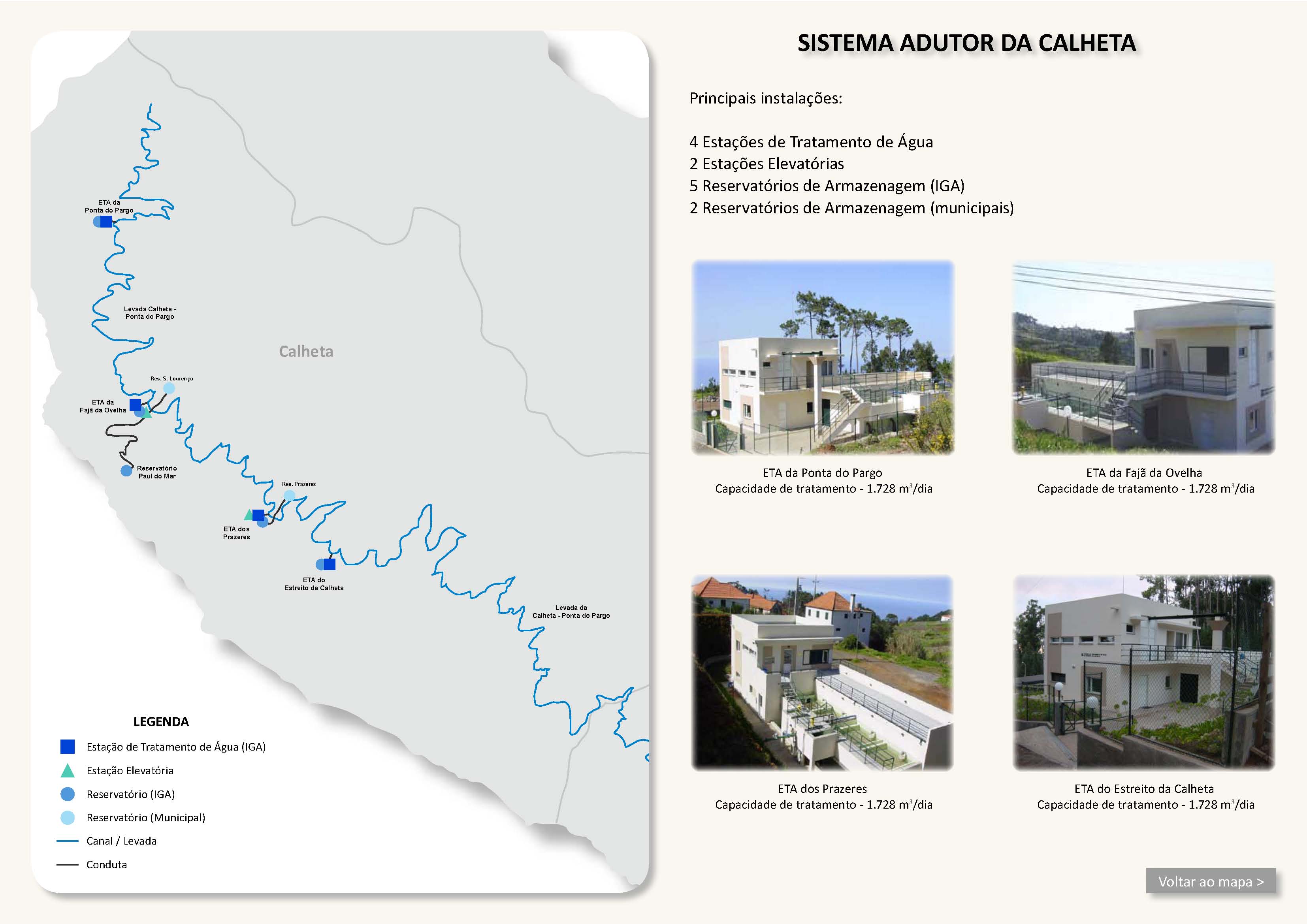
Also known as Levada do Arco da Calheta, Levada da Calheta, Levada da Calheta - Ponta do Sol, Levada Nova do Arco da Calheta, Levada Nova dos Canhas
Archival documentation — not a current hiking recommendation. Source file on danishome.ch last modified: 8 October 2024
Area
South coast/south-west
Length
16,4 km
Year built
1953 (planning began in 1943); the final section from Covas was rebuilt in 2015 on the line of the old levada
Madrei
Calheta I Power Station N 32°44.850 W 17°09.000 654 m a.s.l.
From 2022 the Levada Nova is also fed by the outflow from the Calheta III power station (N 32°44.725 W 17°09.005 664 m a.s.l.)
Course
Above Calheta, Arco da Calheta, Pinheiros, Barreiro e Feiteireas, Lombo de Sao Joao, Covas, Lombo das Tercas, about 300 metres above the Levada do Coronel. The old levada continued about another 100 metres to the next stream
End
Lombo das Tercas ca. 615 m a.s.l.
Function and use
Irrigation of the central south coast. When there is surplus water it is led from Lombo das Tercas down a stream into the Ribeira da Ponta do Sol valley, where it flows into the stream north of the Madre of the Levada Nova and the Levada do Moinho and feeds those two levadas.
Access
Various (Calheta, Canhas, Arco do Calheta, etc.)
Condition
Easy. The newly built final section is somewhat exposed in places, but well protected except for one spot where a landslide has already torn the new railing away again. The old final section is overgrown and hard to reach
Historical notes
The big 1943 plan for new levadas provided for another power station at the end of the Levada Nova, where the overflow to the Ribeira da Ponta do Sol stands today.
The elements would have been the inflow via the Levada Nova, a pressure pipe into the Ribeira da Ponta do Sol, and a turbine house at the Madre of the Levada Nova and the Levada do Moinho. The height difference here is 250 metres. The plan was never carried out, and this part of the levada fell into decay, until it was renovated anew in 2015.
Possibly the plan was to supply extra water to the Madres of the Levada Nova and the Levada do Moinho. Since 2016, water from the western slope of the Ribeira da Ponta do Sol has in any case been led in pipes to the Madre of the Levada Nova and thus indirectly to the Levada do Moinho as well, after the flood badly damaged the old Madre (the dam wall).
By now (2022) this renovated section again looks quite battered; water is unlikely to flow here in the near future.
Remarks
The section from the power station to Arco da Calheta is also called Levada do Arco da Calheta, and from Arco da Calheta to Covas also Levada da Ponta do Sol
An essential part of the water supply of Ponta do Sol and the surrounding area