
Daniel’s Levada Directory
Levada dos Tornos south
Also known as Levada dos Tornos Sued
Archival documentation — not a current hiking recommendation. Source file on danishome.ch last modified: 23 August 2021
Area
Monte, Camacha, Santa Cruz
Length
29.5 km
Construction period
1966
Madrei
Old water house, today the Centro Tematico da Agua (with a permanent exhibition on water in Madeira), in the Ribeira Santa Luzia valley N 32°41.600 W 16°54.950 ca. 640 m a.s.l.
Course
The southern part of the Levada dos Tornos can be divided into 6 sections:
Section 1: From the old water house in the Ribeira Santa Luzia valley, a small tunnel, the Ribeira do Pisao, entrance to the 2nd tunnel towards Monte
Section 2: 2nd tunnel under Monte as far as the valley of the Ribeira Joao Gomes, Curral dos Romeiros
Section 3: Curral dos Romeiros, Choupana, Lombo da Quinta, Palheiro Ferreiro (crossing with the Levada do Blandy), 3rd tunnel under Pinheirinho, Nogueira, 4th tunnel under Nogueira, a short passage to the 5th tunnel, which cannot be walked, Ribeirinha, Salgados (Camacha), entrance to the 6th tunnel into the valley of the Ribeira do Porto Novo. Here, at the tunnel entrance, the large pipes branch off from the levada
Section 4: 6th tunnel, valley of the Ribeira do Porto Novo, 7th tunnel, bridge with a pipe inflow from a small feeder levada and a branch to the Reservatorio do Porto Novo, a fine course in the passages cut out of the sandstone-like rock, 8th tunnel, and before the 9th tunnel the inflow of the Levada do Pico de Gaula. 9th tunnel with caverns; after the tunnel the outflow of the Levada do Pico de Gaula through a closed discharge system, Pico de Gaula
Section 5: Pico de Gaula, crossing with the Caminho da Levada do Pico dos Iróis (or Heróis), crossing with the Levada do Pico das Eiroses, 10th short tunnel under the regional road, valley of the Ribeira dos Vinhaticos, course in the wall on the steep face, crossing with the Levada da Morena in Ribeira do Eixo
Section 6: Ribeira do Eixo to the end at Madre de Agua (valley of the Ribeira de Santa Cruz)
End
Serra da Ameixieiras, Ribeira de Santa Cruz, a waterfall from the end into the Ribeira de Santa Cruz and from here into the Levada Nova do Santa Cruz ca. 570 m a.s.l.
Function and use
Irrigation of the area from Funchal to north of Santa Cruz, and the water supply of Funchal
Access
Section 1.
- In the Ribeira Santa Luzia valley from Corujeira via the Aguas dos Tornos. Use motorway exit 11, up the valley past the bus depots to the roundabout, right there, and stay on the road all the way to the Corujeira sign. Here you have to turn off and drive to the end of the road.
-
From Terca, at the roundabout already mentioned, straight on along the access road to the gravel works in the Ribeira Santa Luzia valley; park somewhere. On the road all the way to the back, and then you come to the museum
-
Descent from the Levada do Barreiro via the Aguas dos Tornos to the crossing with the Levada dos Tornos
Section 2:
- Path from Monte (cable-car station to the botanical garden) to Curral dos Romeiros (junction)
-
Ascent from the Levada do Bom Sucesso
-
Curral dos Romeiros: approach via the Estr. do Curral dos Romeiros, or descent from the ER-201
Section 3:
-
Caminho do Meio (road from the botanical garden to Quinta do Pomar)
-
Caminho do Terço
-
Caminho de Sao Latrao
-
ER-201 in Lombo da Quinta
-
ER-102 in Palheiro Ferreiro
-
Pinheirinho
-
In the neighbourhoods of Camacha
-
Crossing with the Levada do Blandy
-
Access from the Rua da Paz, via a regional road by the Restaurant Achada do Capitao, Vereda do Vermelho
-
Shortly before the Nogueira tunnel, from the Rua da Nogueira either via the Vereda de Nogueira or the path a little further east, straight to the levada divider. Alternatively there is a trodden path that leads straight to the levada divider just behind the fire-station building
-
Ribeirinha after the Nogueira tunnel: first a descent to the exit of the Nogueira tunnel and to the short levada section; a little later the bypass path to the levada after the small tunnel no. 5
-
2 descents from the ER-102
Section 4:
-
2 approaches via Salgados to the tunnel entrance via the Caminho Mun. dos Salgados
-
Access road to the Reservatorio do Porto Novo and on to the Levada dos Tornos.
Section 5:
-
Pico de Gaula (approach from the north on the Levada do Pico das Eiroses, or from the south via the road from Porto Novo)
-
Crossing with the Levada do Pico das Eiroses
-
From the end of the side road of the ER_206
-
From the end of the side road of the ER-206
-
From the end of the side road of the ER-102
-
From the crossing with the Levada da Morena (approach from the ER-102 or from Lamarejas)
Section 6:
-
Side road eastwards in Quatro Estradas as far as the crossing with the Levada dos Tornos; from this road, 3 descents to the Levada dos Tornos
-
From the Madre of the Levada do Moinho da Serra (see also Walk 2014)
-
Path from the Madre of the Levada Nova (see also Walk 2014)
-
Shortly before the end of the Tornos a path leads to the Madre of the Levada Nova do Santa Cruz
This area can also be reached by the road that branches off from Lamarejas (from the road from Santa Cruz to the ER-102) towards Pomar Batista and Madre de Agua.
Condition
Section 1: Not very difficult to walk. Before the tunnel to Monte there is a quite exposed spot, which can however be bypassed via the old bridge in the valley bottom.
Section 2: After the tunnel, a few places as far as Romeiros call for a head for heights.
Section 3: Easy
Section 4: A few places in the Ribeira do Porto Novo valley are somewhat exposed, but not really a problem.
Section 5: Somewhat exposed in places, but straightforward for the most part
Section 6: Easy
Historical notes
The Levada dos Tornos was built in the second phase of the levada plan of the Comissão Administrativa dos Aproveitamentos Hidráulicos da Madeira, inaugurated in September 1966, and since then has supplied the areas east of Funchal with a constantly high flow of water. The northern branch is really only the feed to the south side, where the southern branch provides drinking water and irrigation.
The Levada dos Tornos was built in the second phase of the levada plan of the Comissão Administrativa dos Aproveitamentos Hidráulicos da Madeira, inaugurated in September 1966, and since then has supplied the areas east of Funchal with a constantly high flow of water. The northern branch is really only the feed to the south side, where the southern branch provides drinking water and irrigation.
Remarks
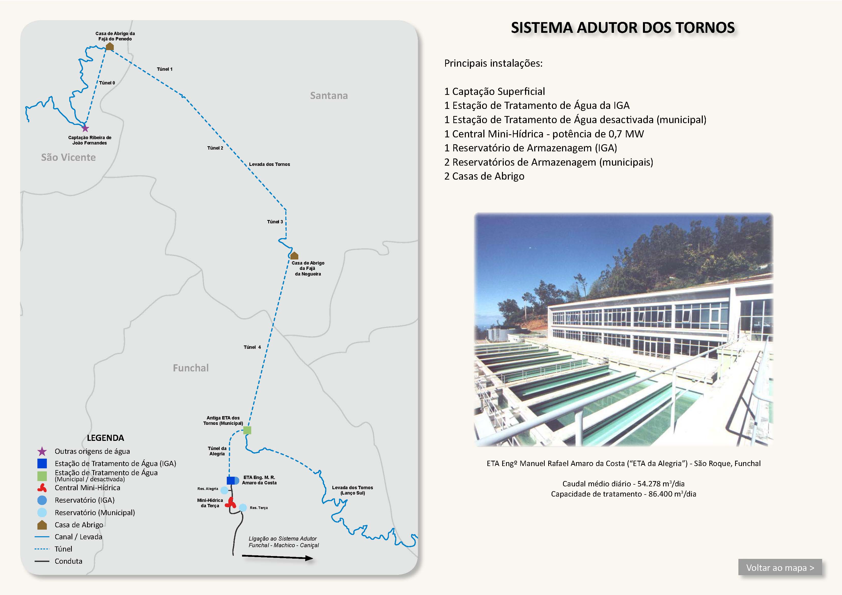
Before the tunnel exit at the old water house in the Ribeira Santa Luzia valley, a tunnel leads to the water treatment plant in Alegria and is thus an essential part of the water supply (Tornos system) of Funchal. The pipe lies underground, is carried under the bed of the Ribeira Santa Luzia and ends on the other side of the valley in a surge chamber. From there the water is led underground to Alegria.
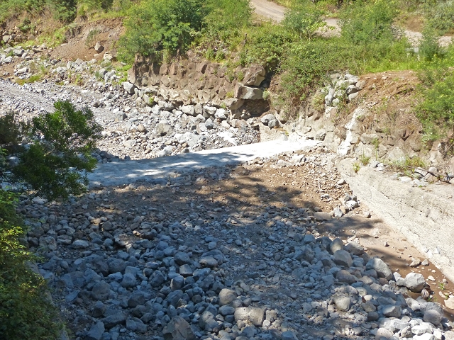
Between the water treatment plant and the reservoir in Terca a 0.7 MW power station is operated, the (Mini-Hydrica da Terca).
The 3rd tunnel under Pinheirinho can be bypassed on a path.
Before the 4th tunnel, water is taken off at a levada divider to the lower course of the Levada do Pico do Arvoredo.
The 4th tunnel under Nogueira can also be bypassed. The bypass path of the 5th tunnel is closed and barred! The official bypass goes around tunnels 4 and 5. The short section in between can be reached from Ribeirinha.
In the Ribeira do Porto Novo valley, drinking water is taken at the Reservatorio do Porto Novo in a tunnel that reaches deep into the mountain. The water is led parallel to the levada in thick pipes towards Camacha. The pipe ends at the entrance of the 6th tunnel and continues underground.
The 8th tunnel can be bypassed. On the outside you can see a channel that belongs to the disused part of the Levada do Pico de Gaula; the bypass path is the old accompanying path of that levada.
Shortly after the tunnel the Levada do Pico de Gaula branches off along the steps of the bypass path and then flows a few metres lower than the main levada, towards the east
In the Camacha area there are reports of occasional attacks (especially in the off season).