Daniel’s Levada Directory
Levada Nova
Also known as Levada Nova da Calheta - Ponta do Pargo, Levada Nova da Calheta
Archival documentation — not a current hiking recommendation. Source file on danishome.ch last modified: 25 October 2024
Area
South coast/south-west
Length
40,6 km
Year built
1953
Madrei
Calheta I Power Station N 32°44.850 W 17°09.000 654 m a.s.l.
From 2022 the Levada Nova is also fed by the outflow from the Calheta III power station (N 32°44.725 W 17°09.005 664 m a.s.l.)
Course
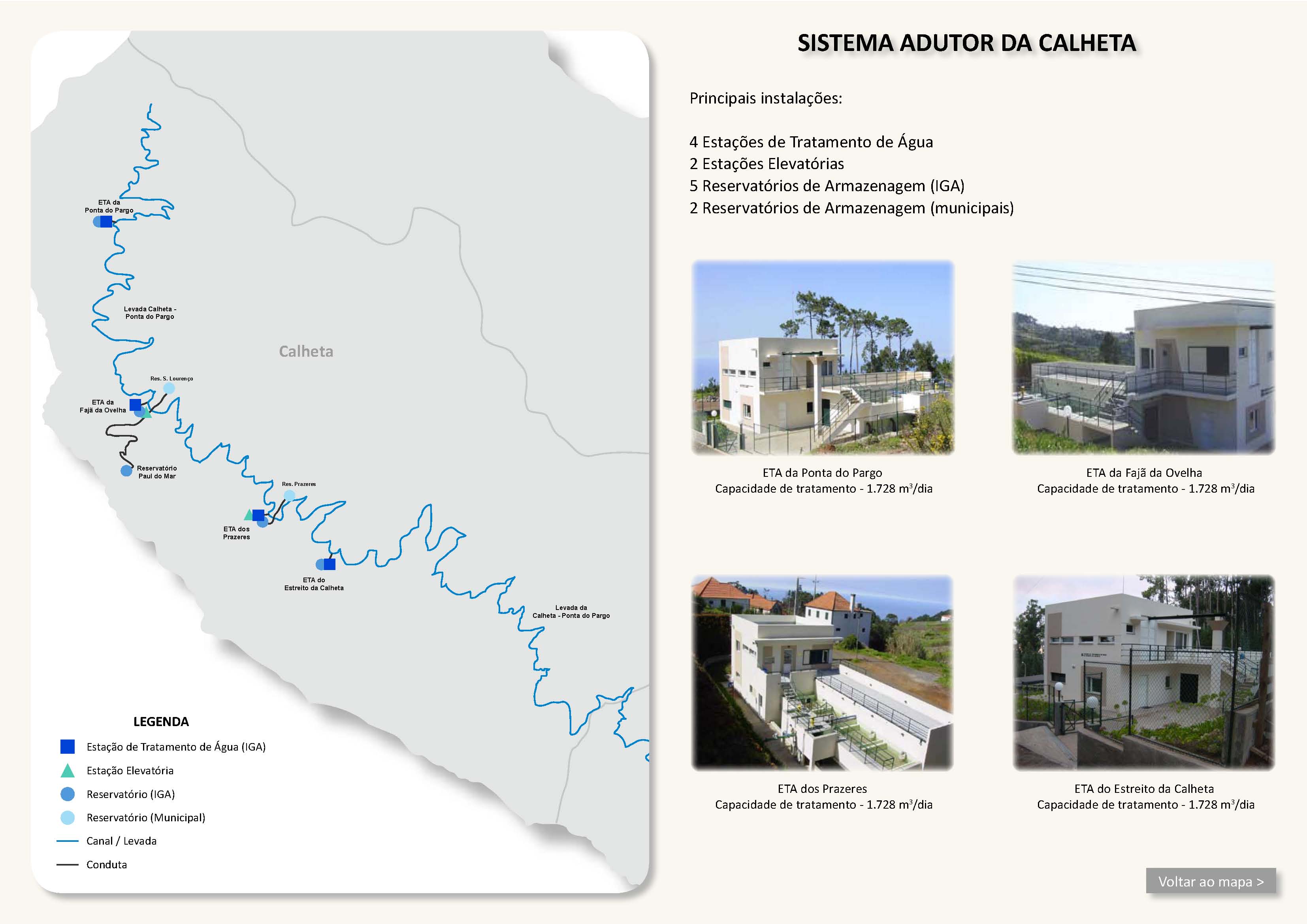
From the Calheta I power station and the Calheta III power station to the reservoir at Achado do Seixo (branch of the pressure pipe to the Calheta II power station), through the woods above Estreito da Calheta as far as Prazeres, then parallel to the ER-101 as far as Amparo, then above Ponta do Pargo via the Ribeira da Vaca to the end at Cabo on the ER-101.
End
East of Cabo ca. 590 m a.s.l.
Function and use
Irrigation and drinking-water supply of the south-west coast
Access
ER-210, ER-211, ER-101, various small paths and roads in Calheta, Prazeres, Raposeira, Faja da Ovelha, Lombada dos Marineiros, Ponta do Pargo, Ribeira da Vaca, Lombada Velha
Condition
Easy
Remarks
Because the Calheta III power station was built, there is a further inflow to the Levada Nova, which crosses the old branch of the eastern Levada Nova (see the pictures)
An essential part of the water supply of the south coast