
Daniel’s Levada Directory
Levada do Plaino Velho
Also known as Levada do Inferno, Levada do Plana Velha, Levada da Ribeira do Inferno, Levada Velha do Caramujo
Archival documentation — not a current hiking recommendation. Source file on danishome.ch last modified: 30 January 2023
Madrei
East of Ruivo do Paul N 32°46.600 W 17°05.250 ca. 1260 m a.s.l., in the western branch of the Ribeira do Inferno
Course
The Levada do Plaino Velho can be divided into 3 sections:
Section 1: From the Madre, after a few metres, through a grass-hung tunnel (very wet); at the exit a little exposed and wet, then with good views as far as the first bend: a view of the huge waterfall below the Madre and of the open-air section of the Levada do Norte Nord. A short tunnel, after which the path from the Levada do Norte Nord meets the levada. 4 shorter tunnels as far as the stream crossing of the eastern branch of the Ribeira do Inferno. Then a fine gallery tunnel and a further tunnel to the point where the descent from the Pico Ruivo da Serra (after a few metres of stepped path, on the right) and the ascent from the Levada do Norte Nord and the Levada da Faja do Rodrigues (after another 50 metres, on the left, downhill) come in. A short tunnel, a longer stretch without tunnels with the crossing of 2 side branches of the Ribeira do Passo, a short tunnel and the crossing of the main branch of the Ribeira do Passo, a fine stretch with a water cave on the right and the typical places where the wall on the valley side is still standing. Stream crossing of the western side branch, which runs into the gorge passage of the Levada da Faja do Rodrigues, a fairly overgrown longer tunnel with a muddy floor and the crossing of the eastern branch of the stream just mentioned, a double tunnel and then without tunnels, with 3 crossings of the side branches of the stream that runs into the large stream-control works of the Levada da Faja do Rodrigues, as far as the gravel track from Ginjas to Estanquinhos.
Section 2: This part corresponds to a portion of the PR-17:
From the gravel track, over 2 small stream crossings of the Ribeira Seca, to a short tunnel, the crossing of a larger side branch of the Ribeira Seca, a short tunnel, on through the gorge-like places already mentioned, but then also with views of Sao Vicente and the surrounding area, crossing 5 side branches of the Ribeira Seca, to a short tunnel, and after that as far as the stepped path of the present course of the PR-17. This path branches off northwards to the Amazonia viewpoint.
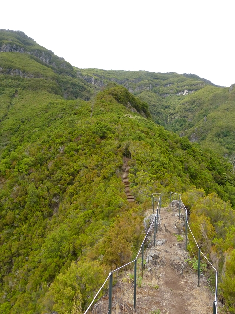
Section 3: The first part can be seen from the PR-17. An overgrown stretch that was once cut generously clear, and that also shows on the satellite images. There are also clear traces towards the stream cut. On old Google Earth images they continue into the next stream bed (above the waterfall that you see from the Levada do Norte Nord). A little to the north of that there is also a path running more or less in parallel, possibly with a connection to the stepped path of the PR-17. This joins the stream cut a little lower down, to the west.
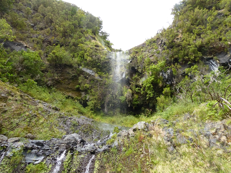
End
Unclear; presumably it once fed the waterfall between the 2nd and the 3rd tunnel, against the flow of the Levada do Norte Nord, ca. 1200 m a.s.l.
Function and use
The Levada do Plaino Velho was completed in 1908 or 1910 with the aim of bringing the unused water from the Ribeira do Inferno into the valley of Sao Vicente. It replaced the Levada do Monte Medonho (now the Levada da Serra), which had been diverted onto the north side. The principle of the work was to stay above the lombo that separates the valley of the Ribeira do Inferno from that of the Ribeira do Passo (the link to the Espigao de Sao Vicente). Long tunnels were presumably not yet possible at that time! That is also why it lies so high. The water was led into the uppermost western side valley of the Ribeira da Vargem, presumably so that the distribution could be controlled as well as possible.
In 1952 the Levada da Faja do Rodrigues was built as a replacement and the Levada do Plaino Velho was taken out of service. So it is not, as I first suspected, a kind of original Norte, but an original Faja do Rodrigues!
Access
Section 1:
-
Descent from the Paul da Serra west of the Pico Ruivo do Paul, an old path, partly neglected, with blazes cut into the trees (see Walk 2015, Walk 2017 or Amigos da Natureza). It is not entirely safe; the path is dangerous!
-
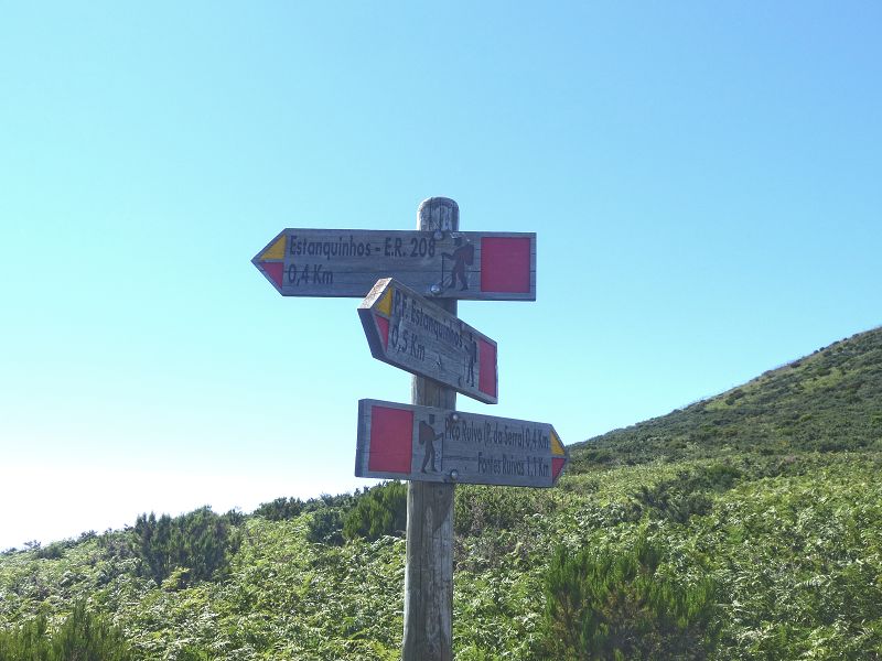
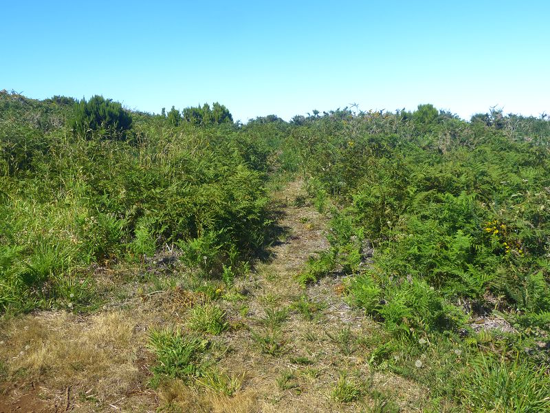
Descent from the Paul da Serra east of the Pico Ruivo do Paul, this signboard, and on this path a fairly well maintained route, in the upper part spiked with gorse depending on how recently it has been walked! (see Walk 2015 or Walk 2014).
-
Access from the gravel track from Ginjas to Estanquinhos (see Walk 2014 or Walk 2015 or Walk 2012).
-
Ascent from the Levada do Norte Nord from the crossing of the first branch of the Ribeira do Inferno. An unmaintained path, partly slipped away, walkable only with a good sense of direction and sure footing (see Walk 2015)!
-
Ascent from the Levada do Norte Nord from the crossing of the Ribeira do Passo; before the tunnel entrance, going west, one path goes up over the tunnel portal and, a few metres earlier, another goes down. Both paths meet the ascent path (Vereda Pau Branco) from the Levada da Faja do Rodrigues to the Levada do Plaino Velho. A steep, somewhat rough path; a sense of direction and sure footing are required (see Walk 2015, Walk 2015 or Walk 2017).
-
Ascent from Sao Vicente via the Espigao de Sao Vicente (see Amigos da Natureza or Amigos da Natureza or Caminheiros do Barrete de Orelhas or Caminheiros do Barrete de Orelhas or Caminheiros do Barrete de Orelhas).
Section 2:
- Access from the gravel track and on the PR-17, past the Amazonia viewpoint
- Ascent from the Levada do Norte Nord via the PR-17. After Folhadal, first a stairway down on the right (see Walk 2015 or Walk 2012 or Walk 2013).
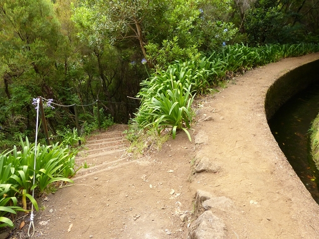
Section 3: From Amazonia or the end of section 2. Shortly before the end, the Vereda das Paredes leads up to the PR17, with a few climbing spots but secured with chains (Walk 2022).
Condition
Section 1: Moderately difficult, in places a little exposed towards the Madre; the last tunnel before the Madre is not entirely easy to reach (wet). Tunnels in good condition, in places a little muddy; the path in fairly good condition depending on how recently it has been walked.
Section 2: Well maintained on the PR-17
Section 3: Overgrown and fallen into ruin, exposed and presumably very dangerous
Historical notes
The Levada do Plaino Velho was built in 1910 as compensation for the diverted Levada do Monte Medonho (now the Levada da Serra). 20 litres of water per second flowed in it.
In the years when the levada carried water, it was also a destination for travellers who came from Ribeira Brava along the Levada do Lombo do Mouro, the Levada do Monte Medonho (now the Levada da Serra), Bica da Cana and the Levada do Plaino Velho, and then went on to the Rabacal area and finally to Calheta.
Remarks
A disused levada, elaborately built! In all there are 15 tunnels, every one of them relatively short and in very good condition. The walk here is a paradise for tunnel enthusiasts, levada devotees and lovers of wild landscapes. Besides that, countless tunnels "open at the top", that is, places where the levada is open but, when the levada bed was cut out, the wall on the valley side was left standing.